
If you think about the hypothesis of the expanding Earth, unrecognized by official science, look at modern maps, then when all the continents (continental plates) are added along their contours, an empty place will remain in the north.
We live on the solid surface of the Earth, continents, islands, but still do not have a clear idea: how these continents were formed, the mechanism of movement, models of their further transformation. That is, we know very little about the Earth. One of the reasons for this is the conservatism of the views of fundamental science, which is often based on the views of a century ago. And these views were then only versions and hypotheses. But they are so heavily entrenched in textbooks and brains that most consider them proven, and therefore - dogmas. But if you dig and start to understand - there are a lot of questions ...
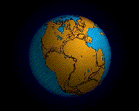
This is not visible here, but all the continents are connected in this configuration. The size of the Earth, of course, should be smaller. There should be no ocean floor. The bottom of all the oceans, even in science, is a young education. The oldest rocks are 250 million years old. (off the coast of the continents). The youngest are in the Mid-Ocean ridges.


They are expanding the area of the oceans. But the scientific world talks only about the drift of continents

Although the map of the depths in the Arctic Ocean tells us that there is no continent, not even a continental shelf there.
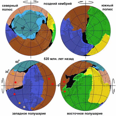
But where do the old maps show the northern continent? Couldn't this be just inventions of ancient authors? The most famous map of the northern continent, Hyperborea, Arctica is the map of Mercator.

The year is 1592. Mundo Prioris Hemisphaerii Sgrooten-Christian

The year is 1531. Orontius-Fineus

1507-Ruysch-Johannes

Year 1593 Cornelius

Hyperboreae

Hyperboreae - polus-arcticus-1597-north-circumpolar

Hyperboreae_Mercator_north_pole_1595

One of the islands of the continent began to sink?

Here, a significant part of the two islands is not shown.


Hyperboreae Gerard de Jode 1593 Map Northern hemisphere

year 1596

1607 Rumold Mercator
All maps show that Hyperborea was in that era when the Caspian Sea was of a different shape (different from modern outlines) Maybe mysterious lands in the Arctic, is not such a myth after all?
Lets talk about the movements of the continents, the so-called continental drift, Wegener's theory and the opposition of this version - the version of the expanding Earth.
According to scientists, once all the continents of the Earth were united into a single supermatter. Then, according to Wegener's theory (why it is a theory is unknown, it does not even pull on the hypothesis), a fault occurred and the future continents began to scatter. You know that.
And now let's remember: the thickness of the continental crust is much greater than the thickness of the oceanic, heavier than it. It turns out that all this cargo on the surface of the Earth was located as if on one side. How is it that when the planet was formed, the forces ordered to concentrate this mass from one end? Even if so, the rotation of the Earth would not be sustainable. Try attaching a piece of plasticine to one side of the flywheel and slowly spinning it!
A silly hypothesis that does not take into account the physics of forces in the rotation of such a system.
Everything is very well explained by the model where the continents formed during the expansion of the Earth: Planet Earth is expanding


https://www.sciencedirect.com/science/article/pii/S1674984715000518
According to the hydride model of Larin or through the etheric model (absorption of ether, synthesis of matter and growth of mass / volume).
"The Hydrid Earth Hypothesis" Movie
Shot in 1984 by the film studio CenterNauchFilm, the tape tells about the views of V.N. Larin on the structure of our planet.
Briefly. The earth's core is not made up of metals, but of metal hydrides, FeH. And the density of hydrides is higher than the density of metals. With the release of hydrogen - their density decreases, the volume increases. The earth is growing. The origin of oil, gas and coal - everything fits into this theory.
But there is another hypothesis of the expansion of the Earth. The earth's core constantly absorbs the ether, synthesizing different elements and increasing the volume:
"Our ideas about the thermodynamic and chemical conditions of the depths of our planet make us see in them environments favorable for the existence of hydrogen bodies. Here the activity of chemical reactions decreases, oxygen quickly disappears, metals such as iron begin to predominate more and more, and, apparently, the amount of hydrogen is growing. At the same time, the temperature and pressure rise. All this should lead to the preservation of hydrogen compounds in these depths, including hydrogen solutions in metals. "
(V.I. Vernadsky, Selected Works, Vol. 4, Vol. 2, pp. 13–14, 1960).
http://hydrogen-future.com
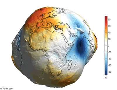
Geoid Eart
The theory of lithospheric plate tectonics is well proven. Continents move relative to each other (GPS stations have proven), the oceanic crust is constantly moving from the mid-ocean ridges towards the continents.
Even if so, the rotation of the Earth would not be sustainable.
The radius of the Earth is 6370 km, and the earth's crust is 40 km. Less than 1%. And even the density of the crust is 2 times less than the average density of the Earth. The center of mass won't change much. In addition, the shape of the Earth is far from a perfect ball, so that an extra "crust" from one edge will not cause a catastrophe.